


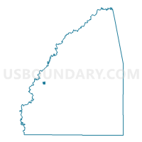
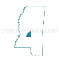
Pearl Voting District, Rankin County, Mississippi
About
Outline

Summary
| Unique Area Identifier | 606550 |
| Name | Pearl Voting District |
| County | Rankin County |
| State | Mississippi |
| Area (square miles) | 0.36 |
| Land Area (square miles) | 0.36 |
| Water Area (square miles) | 0.00 |
| % of Land Area | 100.00 |
| % of Water Area | 0.00 |
| Latitude of the Internal Point | 32.27111860 |
| Longtitude of the Internal Point | -90.13047000 |
Maps

Graphs
Select a template below for downloading or customizing gragh for Pearl Voting District, Rankin County, Mississippi


Neighbors
Neighoring Voting District (by Name) Neighboring Voting District on the Map
- Cunningham Heights Voting District, Rankin County, MS
- North Pearson Voting District, Rankin County, MS
- Patton Place Voting District, Rankin County, MS
- West Pearl Voting District, Rankin County, MS